Area dell'identificazione
Codice di riferimento
Carter MSS i.G.70
Titolo
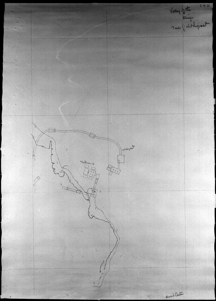
Thebes. Valley of the Kings: sketch map of easternmost branch with plans of tombs KV 20 and KV 43
Date
- c. 1899-1922 (Creazione)
Livello di descrizione
Unità documentaria
Consistenza e supporto
1 sheet
Area del contesto
Nome del soggetto produttore
(1874-1939)
Storia archivistica
Modalità di acquisizione
This material was sent to the Griffith Institute by Mr Walter Hauser from the Metropolitan Museum of Art, New York, in 1955.
Area del contenuto e della struttura
Ambito e contenuto
Howard Carter's hand-drawn sketch map of the easternmost branch of East Valley with plans of tombs of Hatshepsut (KV 20) and Tuthmosis IV (KV 43), Valley of the Kings, Thebes.
Valutazione e scarto
Incrementi
Sistema di ordinamento
Area delle condizioni di accesso e uso
Condizioni di accesso
Property of the Griffith Institute. No restrictions.
Condizioni di riproduzione
Copyright Griffith Institute, University of Oxford.
Lingua dei materiali
Scrittura dei materiali
Note sulla lingua e sulla scrittura
Caratteristiche materiali e requisiti tecnici
- Scale not recorded
- 77.6 x 57 cm
- Housed in archival polyester L-Velope
Strumenti di ricerca
Area dei materiali collegati
Esistenza e localizzazione degli originali
Esistenza e localizzazione di copie
Archived scan in Griffith Institute.
Unità di descrizione collegate
Nota bibliografica
- http://www.griffith.ox.ac.uk/gri/gif-files/Carter_i_G_70.jpg
- KV 20. TopBib i2.548 (plan).
- KV 43. TopBib i2.558 (plan), 559